Handlebars
NAXJA Member #135
- Location
- Albuquerque, NM
This version of Strike Ravine differs slightly from the EJS version and the one Charles Wells shows in his book, Guide to Moab, UT Backroads & 4-Wheel Drive Trails, Second Edition as I completely skip the part of the trail that goes through private property. Be aware that some environmentalists bought the adjacent land and attempted to close all trails through it. There was a court battle over the access to Strike Ravine which the Red Rock 4 Wheelers won so yes you do have the right to travel that part of the trail, despite the gates and "respect private property" signs. The disputed part of the trail is not shown on the following map, but it would run from waypoint Strike Ravine 05, south to waypoint 2904, east to waypoint 2905.
The .gpx file includes a track of the route shown on the following map, which you follow in a figure “8”, as well as 2 sets of waypoints. Waypoints labeled 29## are from the 2nd edition of Wells' book (1st edition did not have this trail), waypoints labeled Strike Ravine ## are my own set. The area of the trail was heavily prospected and there are roads going everywhere, mine are at some of the more confusing turns. Pay special attention at waypoint Strike Ravine 01, the main road goes straight while Strike Ravine turns right on a faint track that leads to Big Ugly Hill.

An xjblue photo of Big Ugly Hill
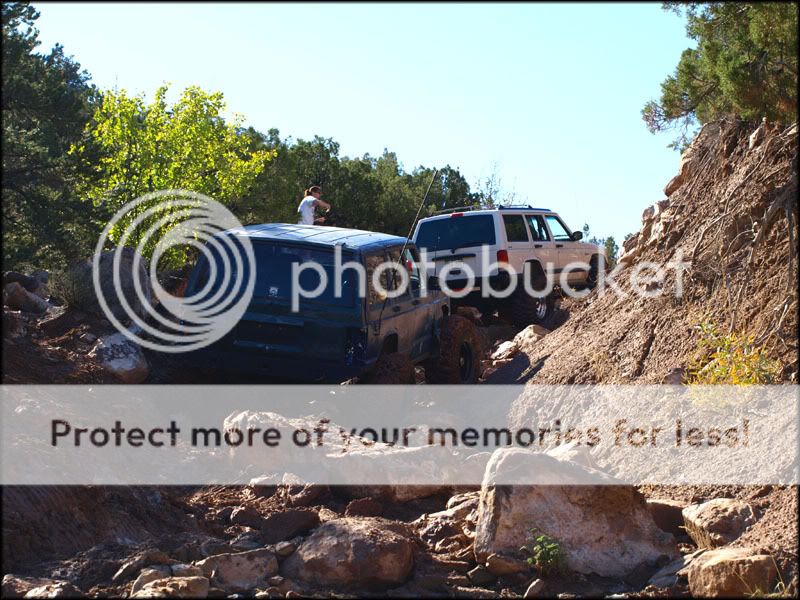
Tom spots on Big Ugly Hill


Crossing the lower part of Pole Canyon

Driving through the upper part of Pole Canyon

The .gpx file includes a track of the route shown on the following map, which you follow in a figure “8”, as well as 2 sets of waypoints. Waypoints labeled 29## are from the 2nd edition of Wells' book (1st edition did not have this trail), waypoints labeled Strike Ravine ## are my own set. The area of the trail was heavily prospected and there are roads going everywhere, mine are at some of the more confusing turns. Pay special attention at waypoint Strike Ravine 01, the main road goes straight while Strike Ravine turns right on a faint track that leads to Big Ugly Hill.
An xjblue photo of Big Ugly Hill
Tom spots on Big Ugly Hill
Crossing the lower part of Pole Canyon
Driving through the upper part of Pole Canyon
Attachments
Last edited: