GhostDakota
NAXJA Forum User
- Location
- Phoenixville, PA | Bethany, DE
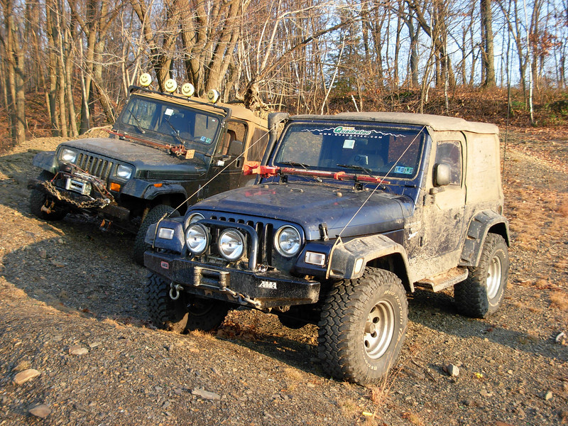
So my one XJ buddy is still repairing his XJ from the t-case exploding last time, so he brought this YJ. I had my TJ. Sorry! lol.
For those who don't know, Centralia is a mining town located in Pennsylvania's Anthracite Coal Region. This type of coal is the longest burning coal in the world. Centralia had a large population in the thousands back in the day. In 1962 a massive, underground mine fire was sparked when the dump was lit on fire. The fire extended to an open coal vein, moved deep down into the earth, and the rest is history. It's estimated that the fire could burn for another 250-1000 years, or more. It may also spread to neighboring Ashland and/or Mt. Carmel due to the connected coal deposits far below. The fire has become so widespread over the years that the government paid to relocate the residents. Nearly all moved out. However, some did remain and the towns current population stands around 7. There are a few houses, an auto repair facility, a fire/police/maintenance building, three cemeteries, and a church. Part of the highway that runs through town, Route 61, was severely damaged due to mine subsidence. It was repaired several times, but has continued to become more unstable. The highway was closed and a new, smaller route, was built to bypass the martian like terrain.
This trip was more of a wheeling excursion than seeing the sights. I've been to Centralia quite a bit, usually 3-5 times a year at least. We did a quick 5 min stop in the area with extreme subsidence. This has some active vents with surface temperatures into the 100's*F. Old energy (Anthracite Coal) is now right next to energy of the future, that of the wind farm on the ridge. My Nikon D2x, used for a lot of these shots, is broken, so I had to manually adjust shutter speed, aperture, focus, etc. (fun):


We then moved to the destroyed portion of the old Highway 61 and grabbed some shots:


After a rather expedited walk around (since we've been there several times before before), we headed off to the other side of town. Our goal was to find area's of open fire, that have been documented in the past. This is easier said than done. We were able to find some prior area's which had been photographed in 1995, but the fires movement since then had diminished the heat & fire on this side of town (Top 2 photos from http://krygier.owu.edu):


We decided to head across the street, and do some exploring. We ended up along the top of ridges for the majority of our day. Vast overlooks abound and made for tons of great places to stop and take in the sites while snacking on food from Sheetz:


For those who don't know, Centralia is a mining town located in Pennsylvania's Anthracite Coal Region. This type of coal is the longest burning coal in the world. Centralia had a large population in the thousands back in the day. In 1962 a massive, underground mine fire was sparked when the dump was lit on fire. The fire extended to an open coal vein, moved deep down into the earth, and the rest is history. It's estimated that the fire could burn for another 250-1000 years, or more. It may also spread to neighboring Ashland and/or Mt. Carmel due to the connected coal deposits far below. The fire has become so widespread over the years that the government paid to relocate the residents. Nearly all moved out. However, some did remain and the towns current population stands around 7. There are a few houses, an auto repair facility, a fire/police/maintenance building, three cemeteries, and a church. Part of the highway that runs through town, Route 61, was severely damaged due to mine subsidence. It was repaired several times, but has continued to become more unstable. The highway was closed and a new, smaller route, was built to bypass the martian like terrain.
This trip was more of a wheeling excursion than seeing the sights. I've been to Centralia quite a bit, usually 3-5 times a year at least. We did a quick 5 min stop in the area with extreme subsidence. This has some active vents with surface temperatures into the 100's*F. Old energy (Anthracite Coal) is now right next to energy of the future, that of the wind farm on the ridge. My Nikon D2x, used for a lot of these shots, is broken, so I had to manually adjust shutter speed, aperture, focus, etc. (fun):
We then moved to the destroyed portion of the old Highway 61 and grabbed some shots:
After a rather expedited walk around (since we've been there several times before before), we headed off to the other side of town. Our goal was to find area's of open fire, that have been documented in the past. This is easier said than done. We were able to find some prior area's which had been photographed in 1995, but the fires movement since then had diminished the heat & fire on this side of town (Top 2 photos from http://krygier.owu.edu):
We decided to head across the street, and do some exploring. We ended up along the top of ridges for the majority of our day. Vast overlooks abound and made for tons of great places to stop and take in the sites while snacking on food from Sheetz:
Last edited by a moderator:


")

