need some Colorado info

Kejtar

PostMaster General
NAXJA Member
I'm looking to hit Colorado this summer and do some exploring. What I'm interested in, is mountain area with some old trails leading up to silver mines. A (long) while ago I remember Alex (Handlebars) posted some really cool pics of the time he spent exploring Colorado.
Anyways, I'm looking for info so if you guys could recommend areas, maps, resources I'm all ears (or eyes in this situation :D)
Thanks
Remi
 
The high mountian trails going to mines are mostly down around Ouray. Extremely pretty, not particularly technical.

BlackBear, Imogene, Engineer are all beautiful. I will see if I can get the pix back up from the NAXJA runs. Further North, there is Taylor Pass, and Pearl Pass. Pearl is only open late summer for a few weeks.
 
old_man said:
The high mountian trails going to mines are mostly down around Ouray. Extremely pretty, not particularly technical.
That's what I'm after: great sites, interesting placed, and not necessarily technical.
 
Kejtar said:
That's what I'm after: great sites, interesting placed, and not necessarily technical.

Then those are the places. If you can handle the switch backs on Black Bear, then everything else is cake. Hopefully Tom gets the pics back up. There are alot of great shots there from the first CO Fest. Wheeling the San Juans is a blast..........:cheers:
 
91 Jeep Project said:
Then those are the places. If you can handle the switch backs on Black Bear, then everything else is cake. Hopefully Tom gets the pics back up. There are alot of great shots there from the first CO Fest. Wheeling the San Juans is a blast..........:cheers:
also: what's the best month to go there?
 
Kejtar said:
also: what's the best month to go there?

Late July through August is the best time especially for the real high mountain trails(most of the snow is melted by then).You could always join us for COfest-starts around the 6th of August-and take some side trips if you want.A very good resource as far as maps,topo,etc. is the Colorado Atlas/Gazetteer complete with GPS coordinates.HTH.
 
Info above excellent ^^ I was typing while Planefixer was ;)

I've been there June, Aug, October. All good. As Jeff mentioned, the earlier, the more likely refrozen snow at high EL.

I was looking at the Coloradofest archives from this years Fest. I didn't see too many active photo links. As you know, COfest was held in the BuenaVista area, which BTW, lives up to it's name quite nicely. Here are some of the pix I took last Aug. The first few are in the front range. Everything past the fried dist cap is COfest.

http://www.mcjag.org/trips/cofest/photogallery/photo22936/real.htm

As usual, I'm going to recomend the books by Charles Wells. Best option is to hook up with a Group, like the folks here, Colorado4X4.com or the COXJ group and if you plan it right you can set up a schedule where you might be able to wrangle a wheeling partner or Group each day of the week :)

Oh, and if you are from a much lower elevation I recomend starting to excersise now ;)
,Ron
 
Last edited:
Zuki-Ron said:
Oh, and if you are from a much lower elevation I recomend starting to excersise now ;)
,Ron
LOL.... even though I'm a lowlander I have no problems with the mountains (as long as I'm not trying to conquer them on a bike :D)
 
Kejtar.........
The San Juans are GREAT!!
Ive been the past 2 years in a row, hopefully it will be an EVERY year thing for me. ;)
All the main trails can be done in a stock 4x4 except Poughkeepsie Gulch.
I also recomend the Charles Wells book. The one for the San Juans is Vol.#1
http://www.mapsco.com/cgi-bin/Mapsc...09df656e273f0c60a7c6070a/Product/View/FUN&2D0
also the Trails Illustrated map..(National Geographic)
#141 / Telluride,Silverton,Ouray,Lake City (looked for a link to the map, could not find one)
I ordered mine over the phone from http://mapsco.com
(this location)
Denver (62E)
800 Lincoln St. Denver, CO 80203
(303) 830-2373 or (800) 456-8703
Hours:
Monday-Friday 9-6 Saturday 10-5

Do you plan on staying at a campground? The KOA in Ouray is a good place.
Here are some sites with info on the area........................
http://www.mycolorado.org/trails.html (HUGE site. Darren,the sites owner, helped me plan my 1st trip. He is a wealth of info on the area.)
http://www.narrowgauge.org/4x4/html/4X4.html (scroll down and click on a trail for pics & info)
http://rver.com/parkdetail.asp?parkid=1 (KOA/Ouray)
http://4x4trails.net
http://colorado4x4.org

Here are pics from my trips if you wanna look..................
2004 (July)
stock XJ w/30's.
http://photobucket.com/albums/v455/drifto77/
Yankee Boy Basin, Ophir Pass, Alta Lakes, Imogene Pass, Engineer Pass, Placer & Picayne Gulch's, Arrastra Gulch and went to The Black Canyon.

2005 (September)
had a 2"bb & 30's this time.
http://photobucket.com/albums/a140/whitecherokee/
1/2 way up Brown Mountian, Corkscrew Gulch, Hurrican Pass, California Pass, California Gulch, Engineer (agian), Black Bear Pass, Imogene Pass agian, Governor Basin and Owl Creek Pass/Silver Jack Reservoir.
 
wow... ok... I'm packing my jeep right now :D
I don't want to stay at a campground: I'd prefer to camp out in the open, so I guess the next question is as to what are the rules in CO in regards to primitive camping?
 
In a National Forest you can camp anywhere that is not expressly prohibited. Same with BLM land. That covers 97% of the San Juans. There is a developed campground on BLM land east of Cinnamon pass that is nice and has good access to the rest of the trails, you can find it if you look.

Fred
 
Kejtar said:
wow... ok... I'm packing my jeep right now :D
I don't want to stay at a campground: I'd prefer to camp out in the open, so I guess the next question is as to what are the rules in CO in regards to primitive camping?
I have a packet from the Forest Service that I got before my 1st trip. I will see if I can find it and give you a quick run down or an address where you can get the same packet I got. ;)
I forgot to mention a time to go.
I would go anytime all the trails are open.
laughingsmiley.gif

Go when the wildflowers are in bloom. When I went in 04 (last 1 & 1/2 weeks of July) I "think" they were at or very near their peak. The season for the bloom up there is SHORT.
There was a LOT more green to the mountians in July than there was in September.
I want to make my next trip for the fall color's. But then agian...... there might be a chance of trails being closed due to snow.
Check out the site that I mentioned before ( http://mycolorado.org/ ) and see when you wanna go by Darren's pics.
Sign his guest book while your there, tell him Rick from Texas sent ya. ;)
here are 3 links for trail conditions........
http://www.soajeep.com/home.html (jeep rental/tour guide place, updates more than the next one)
http://bushducks.com/
http://www.4x4colorado.com/

Just be safe when you go and REMEMBER........ shelf roads can be FATAL!!
(this is on Black Bear Pass)
Picture47.jpg


read this..... (it happened just 3 days after I left Colorado....
http://www.telluridegateway.com/articles/2004/07/28/news/top_stories/news01.txt
then this on 7 Aug of the same year.....
http://www.telluridegateway.com/articles/2004/08/12/news/top_stories/news03.txt
 
Kejtar said:
LOL.... even though I'm a lowlander I have no problems with the mountains (as long as I'm not trying to conquer them on a bike :D)
Let me know when you're going Remi. I could drive up and show you around the area. It doesn't take too much persuasion to get me to the San Juans for a long weekend. :wave:
 
BillR said:
Let me know when you're going Remi. I could drive up and show you around the area. It doesn't take too much persuasion to get me to the San Juans for a long weekend. :wave:
Will do. At this point I'm in the planning stage still.
 
drifto77 said:
I have a packet from the Forest Service that I got before my 1st trip. I will see if I can find it and give you a quick run down or an address where you can get the same packet I got. ;)
well.... guess it got throwed out, i cant find it nowhere. :(
 
If and when any of you ever want to wheel Colorado, make sure and post up here before hand. Colorado doesn't do as many formal trails runs, rather we tend to do runs with just a couple of rigs and a very flexible itenery. I am sure somebody will want to go.

As for the San Juans, I have to make it at least once a year. Both my wife and I were professional photographers and can't resist the photo ops. We tend to take our time and do lots of picture stops.

Remi, there is a place I have always wanted to camp on a spur road just south of Black Bear Pass. I took a wrong turn one time and ended up in an awesome spot. It is above timberline and the view is unbelievable. I can get you coords and a map if you want.
 
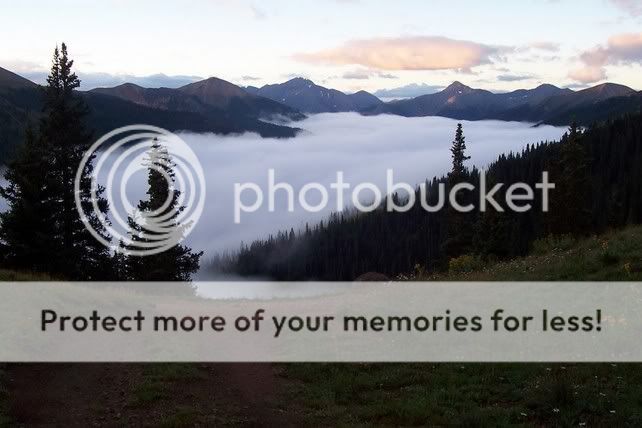
Was'nt above timberline, but here is where we camped on a spur just off Black Bear when we went............
Picture2b.jpg

This was the morning view............
Picture3.jpg


Picture6.jpg

after the clouds/fog went away and down the road just a little bit...
Picture9.jpg
 
Remi, COFest is your best bet. Lots of fun down there, smaller event than Fall Fling (so far). BV is only a couple hours from Ourray so you can hit the trails down there on the way home.

We did the San Juans over Labor Day this year, IMO that's just about right some colors were out already. ALthough if you are going to tent it in the high country you better bring the mummy bag, it was already down into the 30's for lows in Ourray (which is much lower than where you'll pitch a tent)

Bob
 
I'm planning a San Juan trip this summer too, based out of Ouray, early July, and have lots of questions!

Is Black Bear really that easy?

Poughkeepsie Gulch is the only 'technical' trail in the area?

Maybe I need a definition of technical.

Stock 96 4 door, 29" MTR, open diffs, Warn 8k multi mount if it makes a difference for the technical definition.

Traveling with a guy in a 80s Blazer, 3/4 ton, big block, lockers, 37s. Isn't there a trail that he runs into the roof of the 3-sided tunnel on?

Also, where is good fishing, some for me and the wife, some for the kids.
 
Back
Top